LiDAR Workflows
Setup
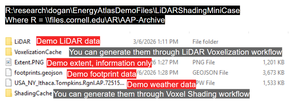
Fetch the demo files
Set up the startup project in Visual Studio (these settings are not git controlled, so we have to configure manually for each machine)
Maui
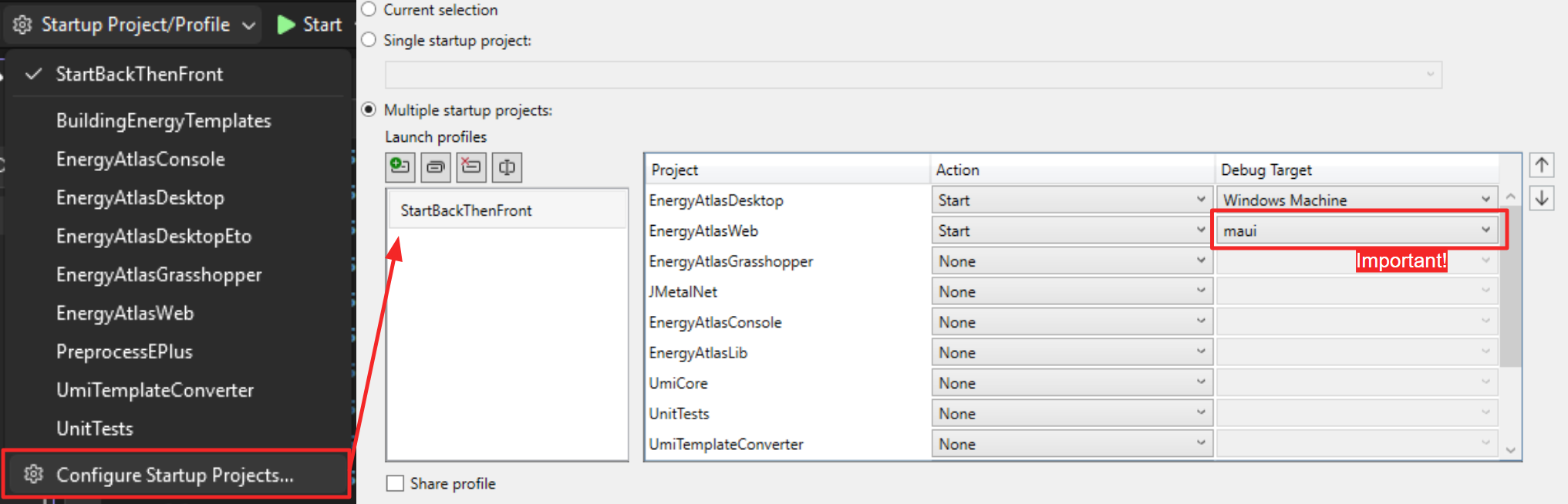
Make sure the Debug Target is maui for the EnergyAtlasWeb project. This determines the ExecutionMode of the application and whether it will have access to the local file system or remain as a typical browser web app.
Eto
Code changes not yet committed; not supported for the moment, apoligies.
Navigating to Jobs
Navigation to the Job List page to find the list of jobs available.
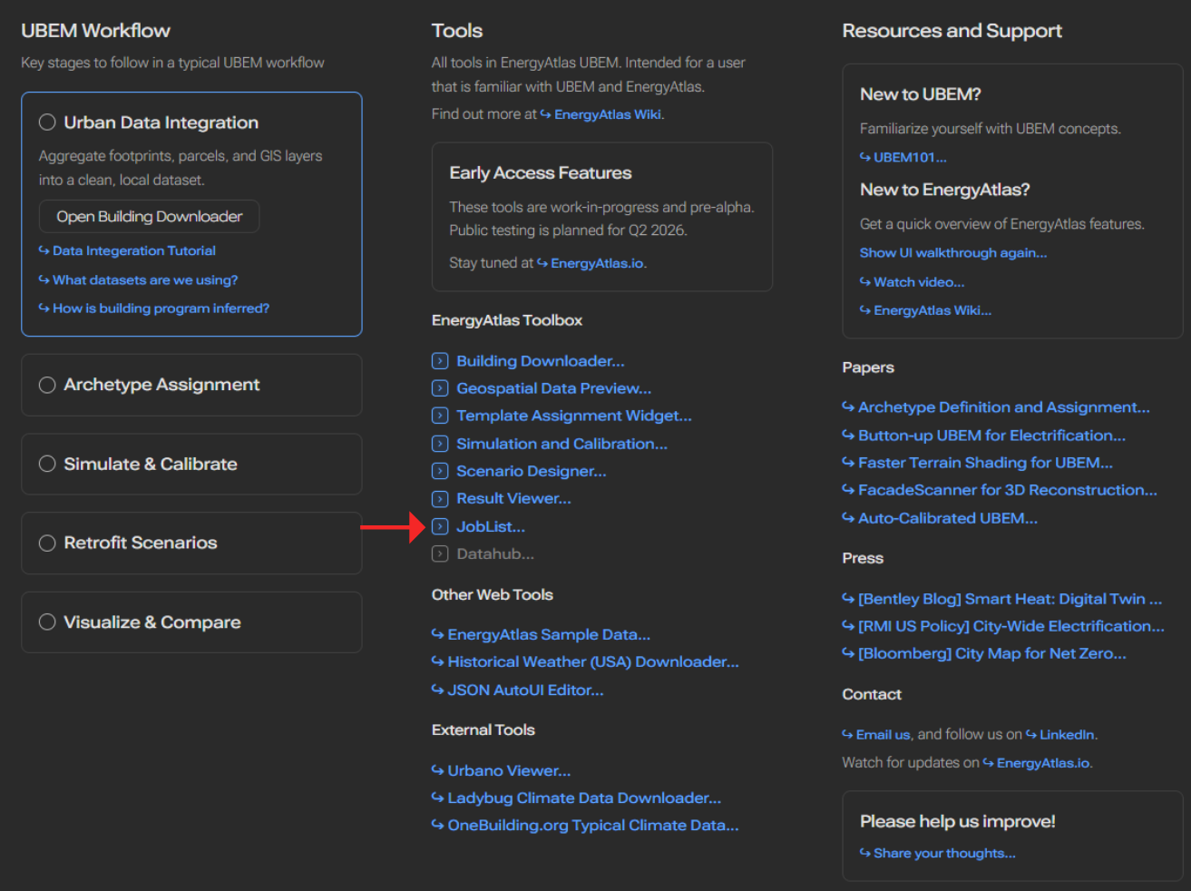
Focus on the middle column with GUIJobs
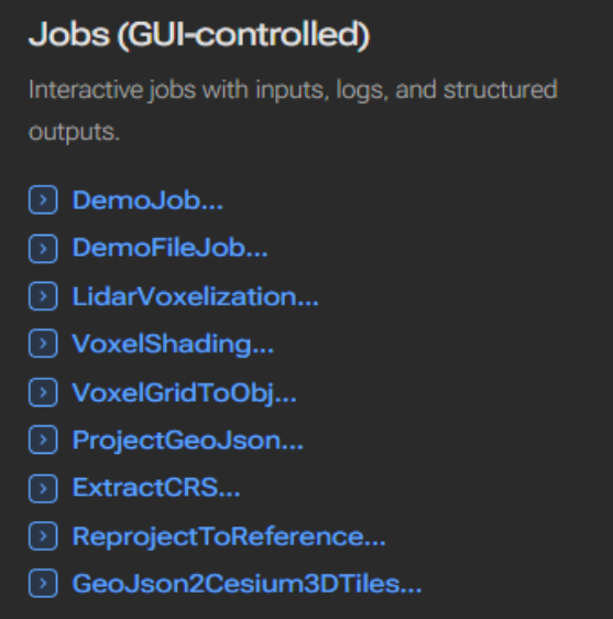
LiDAR Voxelization Workflow
The LidarVoxelization job will voxelize classified LiDAR inputs and drape footprint geometries on the LiDAR tiles to produce the voxelization cache for shading calculation.
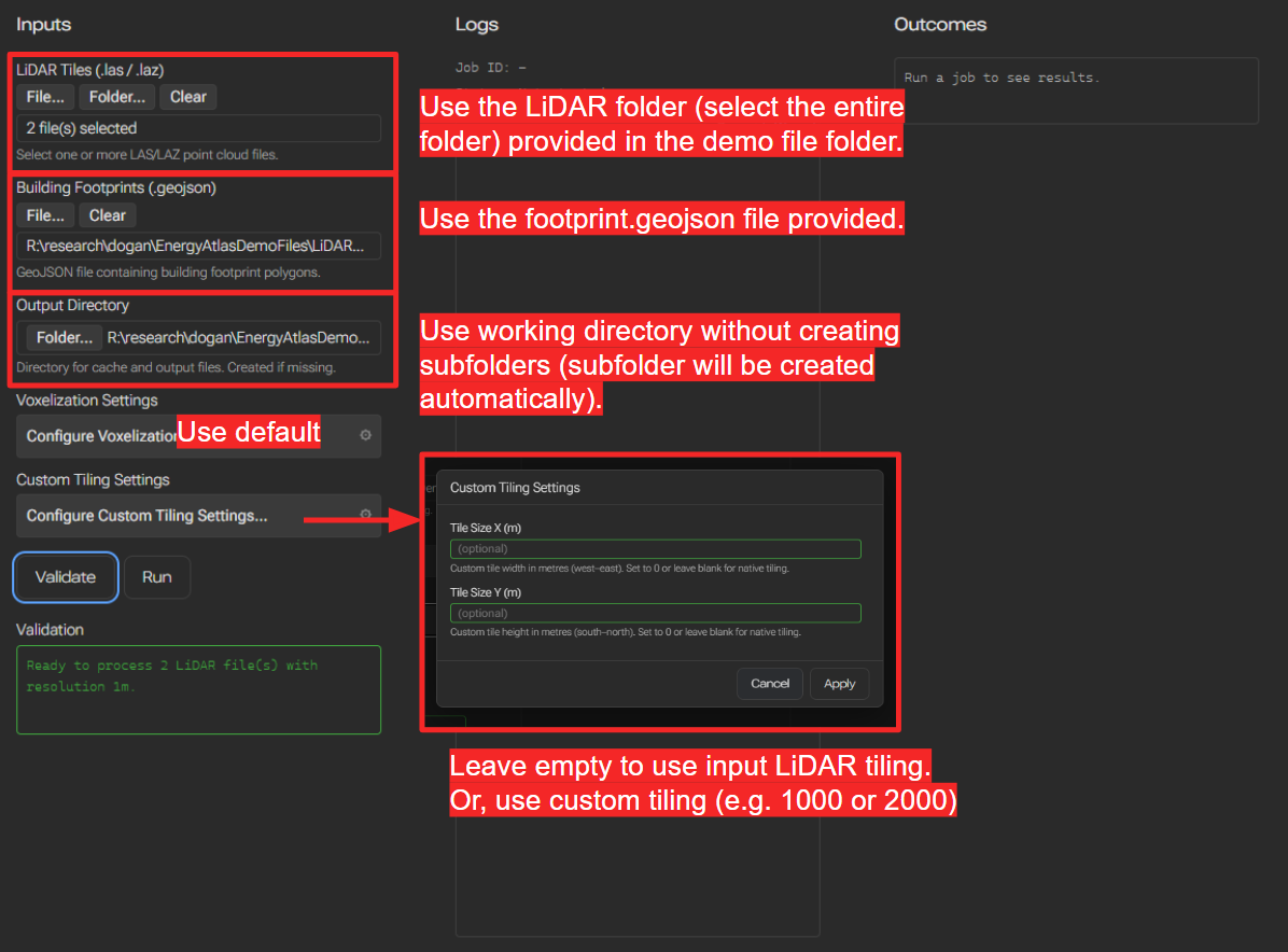
Successfully running this workflow will result in a folder within the working directory called VoxelizationCache, inside which 2 set of files are created:
- A _LiDARVoxelization_metadata.json which records inputs and most importantly, projection information as WKT. They are necessary for the shading workflow to produce the geojson with correct geospatial coordinates.
- As many tile_c{TileXCoord}_r{TileYCoord}_voxelgrid.msgpack files as the number of tiles (including empty tiles). They contain both voxelgrid and draped meshes for each tile.
Voxel Shading Workflow
The VoxelShading job will compute shading using the voxel ray-marching approach. Detailed steps and inputs:
Note: in the latest version, a new toggle is added to allow the user to export full
SunLitFractionarrays in sensor-level outputs.
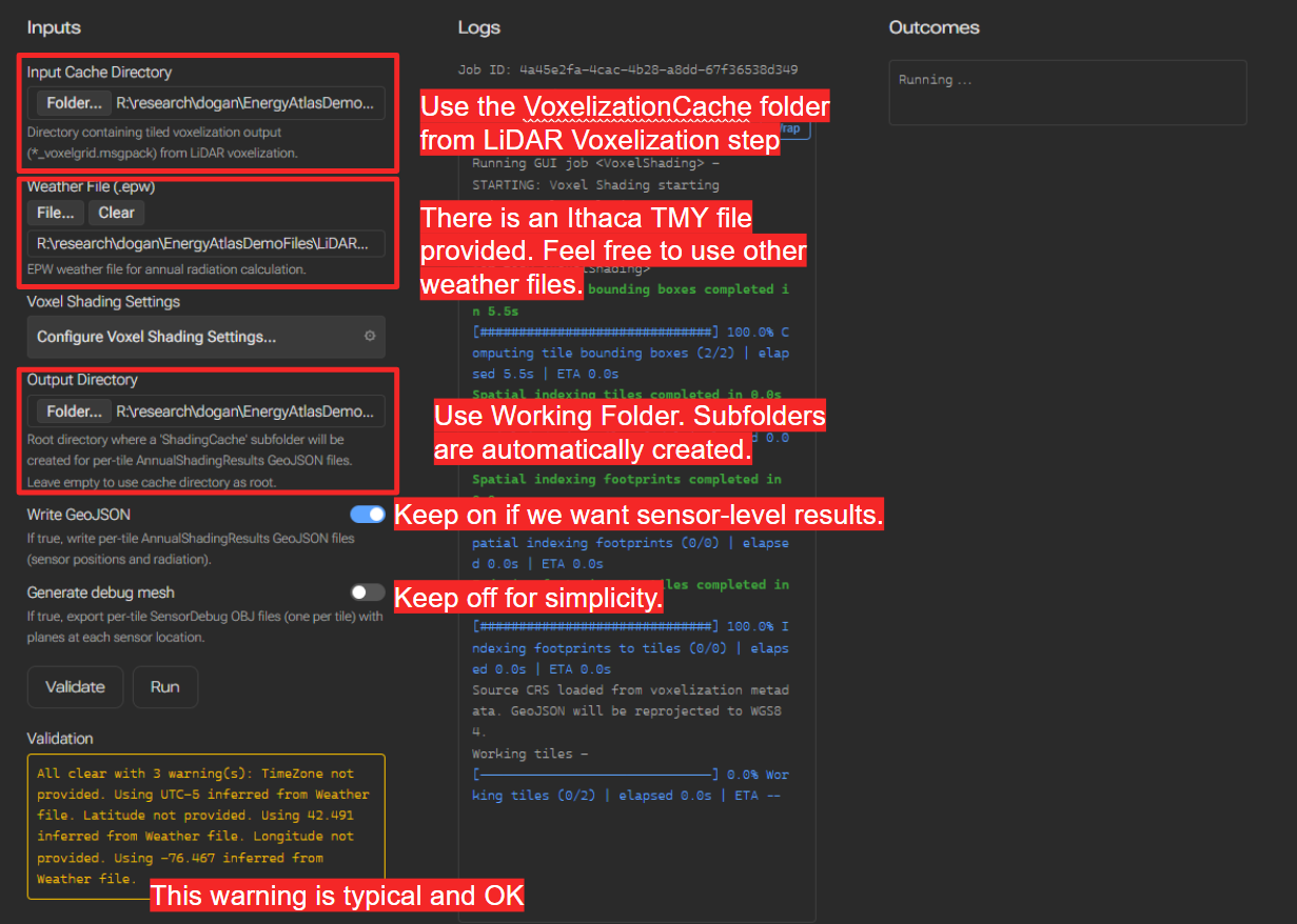
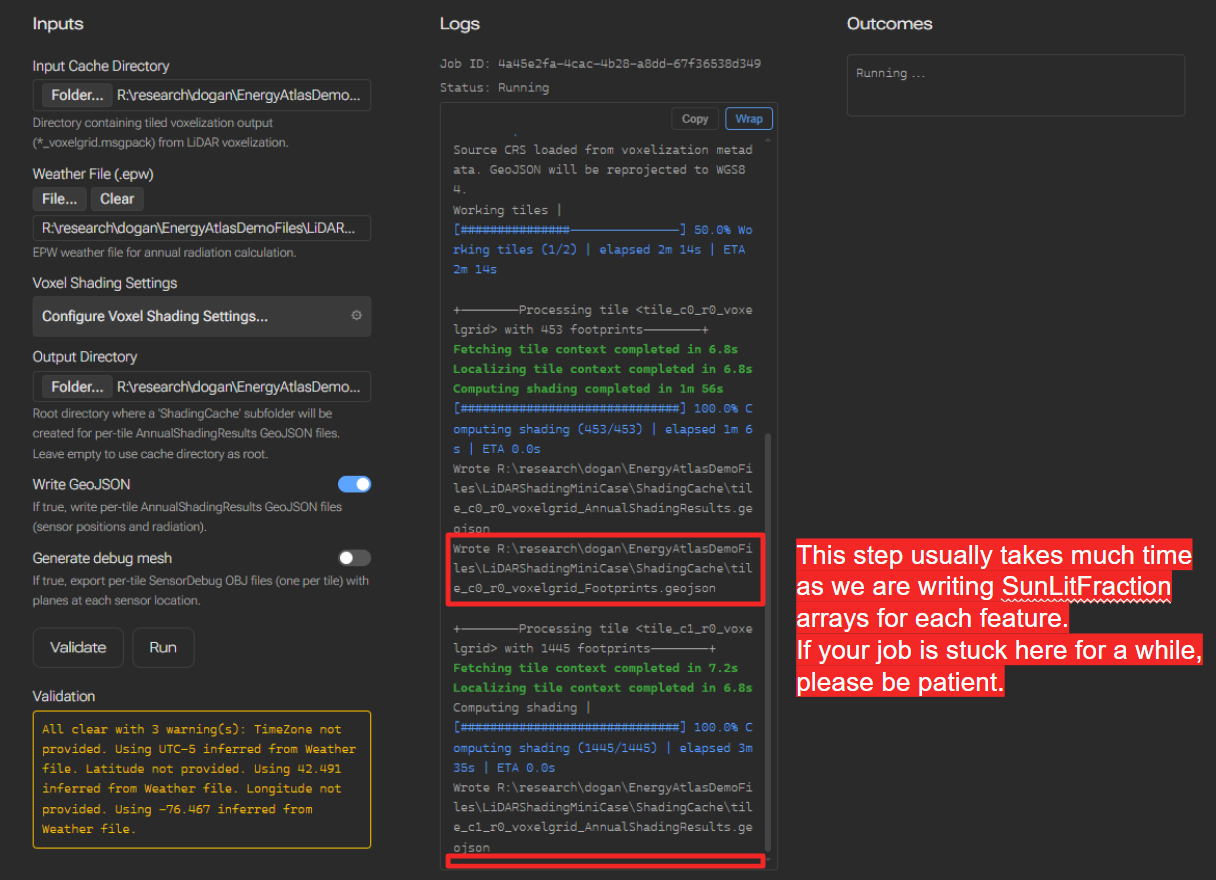
Successfully running this workflow will result in a folder within the working directory called ShadingCache, with files:
- As many
tile_c{TileXCoord}_r{TileYCoord}_voxelgrid_Footprints.geojsonfiles as the number of tiles (including empty tiles). They include building footprint level results (aggregated) with fullSunLitFractionarrays. - (If you opted in for
Write GeoJSONin the input) As manytile_c{TileXCoord}_r{TileYCoord}_voxelgrid_AnnualShadingResults.geojsonfiles as the number of tiles (including empty tiles). They include sensor-level results with 3d coordinates. - (If you opted in for
Generate debug meshin the input) Tile-level sensor debug meshes asobjfiles. For each sensor, a debug square mesh (quad) will be generated, with the correct area of that sensor, normal direction of that sensor, and a color scheme that matches the shading results (for qualitative inspections only, no legend provided).
(Optional) Voxel Grid MessagePack to OBJ Files
The job VoxelGridToObj allows you to convert 1 or many .msgpack voxel grid cache to obj files. The output obj files will contain both voxelized LiDAR and draped footprint base, facade, and roof meshes.
(Optional) Shading Result to Cesium 3D Tiles (.GLB) Workflow
The job GeoJson2Cesium3DTiles allows you to convert shading cache sensor-level result .geojson files (tiled) to a Cesium ion 3d tiles format (.glb 3d geometry file and a tileset.json tileset spec file).